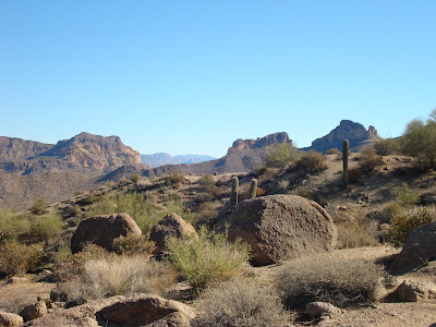
Saturday, December 29, 2007

Hike #22: Brown's Peak Trail, Four Peaks Wilderness, Tonto National Forest

Length: 4 miles

Towering at over 7,600 ft, Four Peaks Mountain stands as the most recognizable landmark on Phoenix's eastern horizon - proudly holding the title of highest peak in Maricopa County. Although Four Peaks Mountain is only 40 miles from the Phoenix area, unless you have a high-clearance vehicle, you will be stuck traveling approximately 80 miles (each way) to access the mountain.

After driving many miles out of the way and slowly following a ten-mile, single-laned (and often snow/ice-covered) dirt road, you eventually arrive at the Lone Pine Trailhead and the start of the Brown's Peak Trail. At 7,657 ft, Brown's Peak is the tallest of the Four Peaks, providing a challenging hike through oak and pine-filled forests.

Although the Brown's Peak Trail provides a gradual climb with beautiful vistas of the neighboring Superstition Mountains and Lake Roosevelt, the true highlight during the winter months is the chance for a snowy hike! Fortunately, with several inches of snow accumulation from earlier this month, the trail provided an exquisite winter wonderland yet maintained a clearly-marked path due to its vast popularity. Although I did not complete the full-hike to the mountain's top, the Brown's Peak Trail provided an afternoon of snowy fun that was pure delight!

To view more pictures of the Brown's Peak Trail, click here.

Tuesday, December 25, 2007

Hike #21: Hieroglyphic Trail, Superstition Wilderness, Tonto National Forest

Length: 6 miles (3 miles if you turn around at the petroglyphs)

Named for a series of Hohokam Indian petroglyphs - which early settlers mistook for Egyptian hieroglyphics, the Hieroglyphic Trail provides exciting hiking options for both the beginner and seasoned hikers. The first part of the trail is well-established and relatively flat, making it ideal for first-time hiker; the second, more challenging, half of the "trail" follows no set path, but instead provides a steep climb through unmarked terrain to the Superstition Ridgeline.

From the parking lot, follow the Lost Dutchman Trail for a couple hundred feet to a well-marked intersection with the Hieroglyphic Trail. Continue along the new trail through a beautiful desert landscape with the towering Superstitions in the background. The trail continues for about a mile and a half to a large series of pools, which are typically full during the winter and early spring. Carved into the stone cliffs next to these pools are the mysterious petroglyphs.

For those that desire an easy hike, now is the time to turn around; for the more adventurous, this is where the fun begins! From the petroglyphs, continue north following the boulder-filled wash. Although the trail has been easy-going so far, this segment will definitely take some time - many of the boulders are quite large and extremely difficult to pass. Following this path, you will soon pass an abandoned mine shaft before coming upon a fork in the wash. Unfortunately, finding the correct fork is apparently quite difficult...with so many drainage routes in the canyon, it's difficult to select the correct fork. I apparently did not do so well.

Leaving the main wash at the canyon's bottom, I began following a minor wash towards the ridgeline. Unfortunately, the path I was following soon became little more than a steep overgrown cliff. After working my way straight up (through some pretty scary spots) for a couple hours, I eventually had to give up and admit defeat. Sadly, getting down was even more difficult than the ascent; I was seriously beginning to wonder if I was going to make it back to the canyon's bottom in one piece! Thankfully, upon reaching the canyon's bottom, it's merely a matter of retracing your way through the boulders back to the established trail.

To view more pictures of the Hieroglyphic Trail, click here.

Friday, December 21, 2007

Hike #20: Picketpost Mountain Trail, Tonto National Forest

Length: 4.5 miles (this is the distance listed in my guide book....but it seemed much, much longer!)

Towering over the small town of Superior, just 40 miles east of the Phoenix area, Picketpost Mountain provides a steep hike that is as rewarding as it is challenging!

Starting from the parking lot, the trail begins by following a portion of the famous Arizona Trail; however, after about a half-mile, the Picketpost Mountain Trail turns to the left and begins a relatively steep climb towards the mountain. Winding through the desert low lands, the trail eventually narrows into a series of slippery, rock-covered switchbacks, which slowly lead to the base of the mountain.

From here, the real work begins! The trail quickly leaves the foothills and advances straight up the mountain side. Fortunately, the trail is well-marked with painted arrows....unfortunately, the vast majority of these arrows are pointing straight up. The next mile is an extremely challenging trek, which is a slow journey that requires much more scrambling than actual walking. My guidebook also warned of a "scary cliff"....it appeared to me that ALL the cliffs along this part were pretty darn scary!

Eventually, the trail flattens again as it reaches the grassy plateau. At the mountains summit is a rusty mailbox with the trips log books. Normally, the plateau provides an amazing view of the surrounding mountain ranges; unfortunately, the sky was completely overcast during my visit.

After enjoying a break at the top, it's time to return down the same path. Although one would expect the return trip to be as difficult as the incline, it actually turned out to be a quick, relatively easy trip, that only required labored scrambling in a few spots. Upon reaching the bottom you can look back in awe that you conquered Picketpost Mountain!

To view more pictures of the Picketpost Mountain Trail, click here.

Saturday, December 15, 2007

Hike #19: Pass Mountain Trail, Usery Mountain Park

Length: 7.4 miles

Located on the edge of the Phoenix Metro Area, just before the Superstition Mountains, Usery Mountain Park provides an environment which most would consider the quintessential Arizona. Although the park is better-known for the challenging Wind Cave Trail (which climbs the park's main feature - Usery Mountain), the lesser-traveled Pass Mountain Trail provides an alternative - and relatively easy - loop hike around the mountain's base.

Beginning from the county-controlled parking lots on the east side of the park, the trail begins by tracing its way through a lush desert landscape. With thousands of saguaro cacti growing from the surrounding sandy mounds, few places could be more stereotypical of the Sonoran Desert. The trail continues along this desert route for the first couple miles with little change.

After about two-miles, the trail turns west and begins a gradual incline. At the hill's summit, a majestic panoramic view of the Superstition Mountain begins to unfold before you! Eventually, a full view of the Superstition Ridgeline is directly before you with the even taller (and often snow-covered) Four Peaks Mountain looming in the background. This beautiful view persist for the next several miles as the trail slowly wraps itself around the west face of Usery Mountain.

Eventually, the trail again turns, leaving the Superstitions, and heading back towards the Metro Valley. The final miles are filled with wide views of the city and a return to the desert floor.

To see more pictures of the the Pass Mountain Trail, click here.

Saturday, November 24, 2007

Hike #18: Peralta/Cave Trail Loop, Superstition Wilderness

Length: 5.2 miles

The Peralta Trail is perhaps the most popular trail in the Superstition Wilderness, which when combined with the Cave Trail, makes for a spectacular loop hike that highlights the best the Superstitions Mountains have to offer.

From the busy parking lot, the loop begins by following the Peralta Trail through a lush green valley, which was quite the unexpected sight in the middle of the desert. After about a half-mile, however, the trail leaves the valley and begins a steady climb into the surrounding cliffs. For two-miles the trail creeps slowly up the mountain until suddenly making a turn and opening to a magnificent view of Weaver's Needle.

From this point, most people choose to turn around and retrace the Peralta Trail back to the parking lot. However, for the more adventurous, there is the somewhat longer (and much more difficult) Cave Trail. When first venturing onto the Cave Trail, the first thing one notices is the isolation; after the crowds of the Peralta Trail, the peace and quiet is almost startling.

Continuing along the Cave Trail is quite easy for the first mile; however, eventually the trail approaches a steep ridge, which you must somehow descend. Once at the bottom, the trail all but disappears. For the next mile, you must carefully follow the small cairns that mark the "trail" (and trust me this is not an easy thing to do...the terrain is extremely rough and many of the cairns are extraordinarily small and difficult to find!) I would not recommend taking this portion of the trail unless you feel very comfortable in your route finding skills (and preferably only in a group!)

Eventually, the Cave Trail does work its way down from the hard volcanic rocks into the more traditional desert, where the trail again becomes visible. From here, it is an easy trip back toward the Peralta trail and an easy exit.

To view more photos of the Peralta and Cave Trails, click here.

Thursday, November 22, 2007

Hike #17: Hidden Valley Trail via the Mormon Trail, South Mountain Park

Length: 4 miles

South Mountain Park, with over 16,000 acres on the southern edge of Phoenix, is the largest city park in the United States. With numerous trails and a close vicinity to town, South Mountain Park is wildly popular! (In fact, most days the trails are extremely busy and parking can be impossible unless you arrive very early.)

The hike begins with a steep 1.5 mile climb up the Mormon Trail. Although several books claim that this portion of the trail is gradual and easy to master, I found it much more challenging than expected. While the trail is shaded during the morning due to its position on the north side of the mountain, the stair-like aspect of the trail left me exhausted and dripping in sweat.

After reaching the summit, the trail opens to a large, flat mesa and intersects with the National Trail. Be forewarned that the National Trail is a very popular biking trail, so you will be yielding to numerous bikers. From the Mormon Trail, you can turn either way on the National Trail; however, my sources recommended continuing to the right since it's slightly easier to traverse Hidden Valley from west to east.

After following the National Trail for about a half-mile, one will see the clearly-marked Hidden Valley Trail. This is where the excitement begins! Almost immediately upon turning, one encounters the highly popular Fat Man's Pass. This 25-foot long crevice between two massive boulders narrows to only 9-inches at one point, so take your pack off and slide through sideways! (If your width happens to exceed 9-inches, you can merely climb over the boulders - which can be done quite easily.) The trail continues through the desert valley for about a half-mile before entering an area of large boulders. Continue along the boulders, but be very careful because the boulders have been worn smooth by years of hikers. Finally, the Hidden Valley Trail finishes with an impressive nature tunnel created by several fallen boulders (pictured above).

Once exiting the tunnel, return to the National Trail and continue left towards the Mormon Trail. Once reaching the Mormon Trail, continue back to the parking lot with wonderful views of Phoenix greeting you the whole way!

To see more pictures of the Mormon Trail and Hidden Valley, click here.

Saturday, November 17, 2007

Hike #16: Cave Creek/Skunk Tank Loop Trail, Tonto National Forest

Length: 10.4 miles

The Cave Creek/Skunk Tank Trail, though quite long and challenging, provides a welcome break from the typical desert climate one expects so close to Phoenix.

Beginning at the popular Seven Springs Campground, the loop begins by following the Cave Creek Trail along the banks of Cave Creek. In the late fall (mid-November), this area will be easily identifiable by the rich gold color of the fall foliage from the various non-desert vegetation growing along the creek bed. (Several of the guide books state that this area is also rich in wildlife and that it is quite common to see or hear javalinas among these riparian areas - sadly I did not encounter any major wildlife.)

The trail continues along this path, repeatedly climbing the hills adjacent to the creek and then falling back towards the creek and valley bottom. Although this portion of the trail does require one to cross the creek three times, the water is generally extremely shallow and poses little difficulty when crossing. Unfortunately, finding the correct spots to actually cross is by no means anywhere as easy! Be on the lookout for the small rock cairns marking the crossings...otherwise you'll never find the proper spots. (I spent 30 minutes trying to locate the third crossing...and still ended up having to climb a steep, overgrown slope to land on the established trail again.)

Shortly after the third creek crossing, the Cave Creek Trail intersects the Skunk Tank Trail. From here, you can either turn around and retrace your way back over the easy Cave Creek Trail, or continue along the more difficult Skunk Tank Trail.

The Skunk Tank Trail immediately begins with a two-mile climb into the mountains away from the creek. The first mile or so isn't so bad due to a nice breeze common at the higher elevations; however, you soon turn between two mountains, and this breeze completely disappears for the next mile or so (making for one blisteringly hot climb!) Although the Skunk Tank Trail does provide a nice panoramic view at the top, it can by no means match the beauty of the Cave Creek. My advice would be, unless you desire a challenging workout, turn around where the Cave Creek and Skunk Tank Trails meet and enjoy a leisurely return hike along the creek!

To view more pictures of the Cave Creek/Skunk Tank Loop Trail, click here.

Sunday, November 11, 2007

Hike #15: Black Mesa Loop Trail, Superstition Wilderness

Length: 8 or 9 miles (depending on the source you read....I would believe it closer to 9)

The Black Mesa Loop Trail is actually three trails, the Lost Dutchman Trail, the Black Mesa Trail, and the First Water Trail, which when combined make for challenging 9-mile hike.

The loop begins by following the Lost Dutchman Trail for about 4.5 miles. With a variety of desert vegetation and breath-taking views, this is by far the best portion of the loop. The cliffs overlooking the trail provide welcome shade along the first segment of the hike; however, after a couple miles of gradual incline, the trail leaves the cliffs and opens for a wide panoramic mountain view. After another couple miles, the trail approaches a large flat wash, where it intersects with the Black Mesa Trail. (Note: This can be really difficult to find since the trail all but disappears in the wash. Know that if you come upon the sign for Boulder Canyon Trail, you have gone too far and need to retrace the trail back about 500 yards until you see the wooden marker for the Black Mesa Trail.)

The Black Mesa Trail is the middle 3-miles of this loop. Although this segment of the loop does provide a good variety of vegetation, the views are nothing when compared to those of the first portion. I will advise to watch out for the forests of Jumping Cholla Cactus, which have VERY prickly barbs.

Eventually, the vegetation grows more sparse, and the loop connects with the final 1.5-miles of the First Water Trail. Although this portion passes through a couple minor washes, it is otherwise unremarkable.

To see more pictures of the Black Mesa Loop Trail, click here.

Saturday, October 20, 2007

Hike #14: Granite Mountain Trail, Prescott National Forest

Length: 4 miles (only a portion of the trail)

After my last rather disappointing visit to the Prescott area, I was a little hesitant to return to the area. However, when a colleague recently mentioned she was organizing a group to attend a nature hike in that area, I said 'what the heck' and added my name to the list.

Fortunately, I can say my second visit to the Prescott National Forest was much better than the first. While the forest along the south side of town seemed to be little more than overly-developed shrubland, the forest north of Prescott was full of majestic granite mountain cliffs and areas of rather diverse forest vegetation (which in late October provided some rather nice fall foliage.)

Granite Mountain Trail is actually relatively easy to follow. Starting near the Granite Basin Lake, the trail follows and easy path for the first mile until you come to a large wooden fence. After the fence, the trail begins a quick assent with a series of rather steep switchbacks. Although it may be a bit of a workout, the view from above is well worth the effort! I will definitely be planning a return trip to the Granite Mountain for more exploration of the many trails this area has to offer.

To see more photos of Granite Mountain Trail, click here.

Saturday, October 13, 2007

Hike #13: Horton Creek Trail, Tonto National Forest

Length: 10 miles (8 miles of the Horton Creek Trail plus 2 miles of the Highland Trail)

As the name suggests, the Horton Creek Trail traces its way along the Horton Creek to its spring source. As the creek slowly tumbles its way to the bottom, the trail weaves through the forest beside the creek. The forest itself is quite beautiful; with a large numbers of oaks and maples, this forest is perhaps the most "eastern" of any I've yet seen in Arizona.

However, the creek is by far the true star of this trail. With the cool spring being at the top of the mountain, the creek has to work its way down the gradual slope - this means more picturesque waterfalls than one could imagine! In fact, I would highly recommend foregoing the established trail and working your way along the makeshift trails along the creek banks whenever possible!

My only complaint about this trail is the difficulty in locating the second trail that was suppose to complete the loop. Although I walked the Highland Trail for a good mile, I found very few trail markers and knew little about where the return trail was suppose to be....so, I chose to return the way I came rather than continue towards the unknown.

To see more pictures of the the Horton Creek Trail, click here.

Monday, October 8, 2007

Hike #12: Butcher Jones Trail, Tonto National Forest

Length: 2 miles (just a short portion of the trail)

With the cooler weather in the Phoenix area lately, I decided to try another attempt at the Superstition Wilderness, which is the mountainous area just east of the city. Several months ago, I attempted the Boulder Canyon Trail...only to succumb to the heat and humidity of July in Arizona. Well, I can gladly say that the weather was perfect this morning for my trip to the Butcher Jones Trail!

The Butcher Jones Trail traces it way through the riparian and desert areas along the western shores of Saguaro Lake. The lake, which is the smallest formed by a series of dams along the Salt River, provides a beautiful oasis of wildlife and vegetation quite uncharacteristic of the desert. The first 1/4 mile of this trail is well-developed with paved sidewalks, hand railings, and plenty of trees.

However, the trail soon leaves the shoreline, and the path becomes much rougher! For about a half mile, the rocky trail weaves it's way between a variety of interesting cacti. Unfortunately, the trail soon all but disappears....becoming overgrown and all but impossible to follow. Although I made several attempts to find the correct path, I only found myself scrambling again and again through low underbush! In the end, I had to admit defeat and give up on the Butcher Jones Trail.

On a side note, I would like to mention that all areas surrounding the Saguaro Lake require a Tonto Forest Parking Pass. Before I went this morning, I had read a number of sources that said that the fee had either been discontinued or that you could pay for the permit on site. Neither of these things were true! You must purchase a day pass at a gas station in town before heading out there...learn from my mistake and save yourself the extra 20 miles required to return to the nearest gas station!

To see more pictures of the Butcher Jones Trail and Saguaro Lake, click here.

Saturday, September 29, 2007

Hike #11: Historic Bell Trail, Wet Beaver Creek Wilderness, Coconino National Forest

Length: 7 miles

The Bell Trail, which weaves through the cliffs surrounding the Wet Beaver Creek, is just a few miles north of the West Clear Creek Trail. While the West Clear Creeks Trail runs directly along the creek with the cliffs towering overhead, the Bell Trail sit high atop the cliffs with the creek running far below.

The trail itself can nicely be divided into three sections. The first section runs through open mountains, blanketed in massive amounts of prickly pear cacti. Perhaps the highlight of this first portion is a large igneous boulder covered in ancient petroglyphs. The middle section of the trail slowly climbs through some of the most beautiful red cliffs I've yet to see in Arizona. The trail's narrow ledge allows for spectacular beauty from both above and below...just be careful not to fall off while you're staring with awe at the cliffs overhead! Finally, the trails descends to the lower cliffs immediately next to the creek. From here, you can either jump in for a relaxing swim in the deep cool water or merely enjoy the amazing view. Overall, these diverse elements combine
for an exciting and surprising hiking experience!

For anyone actually considering hiking this trail, I definitely recommend this guide. Mr. Reynolds did an excellent job of describing this trail with extremely helpful instructions that gave the distance between landmarks in time rather than mileage. (It's much easier to gauge how long you've traveled rather than how far!)

To view more of my pictures of the Bell Trail, click here.

Sunday, September 16, 2007

Hike #10: Willow Springs Trail, Apache-Sitgreaves National Forest - Attempt #2

Length: 8 miles

After my failure to find the Willow Springs Trail on my last visit, I decided that it was worth a second attempt. With the knowledge from my first attempt, this time staying on the correct path was no problem!

The actual Willow Springs Trail was a very nice journey. Although there wasn't nearly the amount of wildlife as on the other "trail" I mistakenly followed, the real trail did provide an abundance of wildflowers and scenic bogs. However, the highlight of the trail was Willow Springs Lake - a small man-made lake, which the trail hugs for about 3 miles.

The Willow Springs Trail makes for an excellent summer hike. At an elevation of 7,600 ft, there is a constant breeze (which when coming across the lake can be down right cold!) Had it been a little warmer, I might have been sad not to have any swimwear...the lake's amazingly clear water is definitely beckoning. The only drawback to this trail is that the last couple miles follow a rather bland path carved for a series of electric lines - not exactly the greatest of scenery after the beauty of the bogs and lake.

To see more picture of the Willow Springs Trail, click here.

Saturday, September 1, 2007

Hike #9: Willow Springs Trail, Apache-Sitgreaves National Forest

Length: 8 miles

This morning, I set off towards the northeast to check off another of Arizona's National Forests - the Apache-Sitgreaves National Forest. The plan was to hike a well-known bike path - the Willow Springs Trail, another of the "30 Summer Hikes" from Phoenix magazine.

Now, while I had no difficulties in following the magazine's directions to the trailhead, following the "correct" trail was a different story! In the magazine article, it stated that the trail would fork after 1/2 mile and that it was advisable to take the right path. Now, after less than a 1/4 mile, there was a fork...clearly too early to be the "1/2 mile" turn-off. Nevertheless, I followed the trail to the right and followed the blue markers. After awhile, I came to another fork and turned right thinking that this was the "1/2 mile" fork. Now, the left trail of this fork was clearly marked with this trail sign, which I chose to ignore (however, I'm blaming this mistake on this other fallen sign!)

I, now, know that I should have followed the trail sign instead of listening to the author's brief summary. Although I didn't get to see the promised marshlands and lake that the original trail detailed, I did see a large variety of wildflowers and several elk. (In fact, at one point I tried to creep up on a herd of 8-10 elk, which was quite the sight to see!)

To see more pictures of the Willow Springs Trail, click here.

Saturday, August 25, 2007

Hike #8: West Clear Creek Trail, Coconino National Forest

Length: 8 miles

After seeing the West Clear Creek Trail included on multiple "best trails" lists, I decided that I had to see what all the hype was about. Fortunately, I can say that the West Clear Creek Trail completely lived up to its reputation!

The trail, which as the name suggests follows the West Clear Creek, provides lush green forests, beautiful red cliffs, and multiple chances for water excursions! (In fact, you'd better bring your water shoes along because the trail crosses the creek 4 different times. And trust me, you'll want to wear your water shoes at each crossing...after walking a mile in soaking wet hiking boots, I can personally attest to this!) I would also recommend wearing/bringing swimming apparel so that you can take the time and actually enjoy a cool dip in the water.

The West Clear Creek is a little busy at its start with swimmers, but the further you get from the trailhead the more secluded it becomes. In fact, when first entering the Wilderness area there are so many trails leading to the creek that it can be hard to stay on the main "West Clear Creek Trail". I personally would recommend skipping the first part of the established trail and enjoying a relaxing hour of exploration along the creek. Just know that you can always find the main trail by working your way left from the creek.

To view my photos of the West Clear Creek Trail, click here.

Sunday, August 19, 2007

Hike #7: Sierra Vista Mountain Range, Coronado National Forest

I woke up this morning with the intent of heading north to the Wet Beaver Creek Wilderness; however, when I got in my car, I spontaneously decided to spice it up and head south towards Tucson and the Green Mountain Trail (another of the famous 30 Summer Hikes.) I had assumed that the general directions from the magazine would be enough to get me to the trail...so I didn't bother to run back into my apartment to look for detailed directions or a map...BIG MISTAKE!

I had no trouble making it to Tucson (even though the vast majority of downtown Tucson was under construction.) However, when I got closer to Coronado National Forest, I apparently followed the wrong highway (even though I have NO clue how this happened!) Anyway, instead of ending up in the nice hiker-friendly area with lots of trails, I found myself in the white trash region of the forest! Instead of the quiet hikers with their friendly dogs, I was in some type of twilight zone of the forest - everyone was either shooting rifles at the distance cactus...or riding a dirt bike/ATV.

Well, since there weren't any trails along the road I traveled, my trip today was more of a drive rather than a hike. However, the view of the mountain was pretty amazing...and I found the cow crossing signs to be pretty funny. I did try to make the best of a bad situation by making several stops along the dirt road and venturing out among the rocks...following whatever makeshift trail I could create (though I would warn against this due to the sharpness of cactus and most other desert vegetation...plus the numerous broken beer bottles and shotgun shells.)

To see more pictures of the Sierra Vista Mountains, click here.


Sunday, August 12, 2007

Hike #6: Donahue Trail, Tonto National Forest

Length: 6.5 miles

Today, I again ventured north to the Tonto National Forest to hike one of the "30 Great Summer Trails".

The Donahue Trail was quite different from my previous hike in the Payson region of the Tonto National Forest. The Donahue Trail had the same beautiful mountain scenery as well as spectacular views of the Mogollon Rim; however, unlike my previous trek in the area, the Donahue Trail goes straight up and provided an amazing panoramic view of the area from above!

Unfortunately, these wonderful views did come at a price - the Donahue Trail is a 3-mile climb to the top of a fairly steep mountain! The first half of the trail was well shaded and fairly flat...however, the second half was a series of switchbacks leading to the top of the mountain. (Switchbacks are a series of zig-zagging trails that gradually lead to the top/bottom of a mountain.) After going back and forth, over and over again, you begin to think that the top of the mountain is never going to come. Although this makes for hard going on the way up, the way down is fast and simple. In fact, on the way down we were rewarded for all our hard work by the breathtaking view of a large elk standing just off of the trail.

Although the heat and steepness of the trail made for hard-going, the remarkable views and the chance to interact with wildlife easily made it all worthwhile.

To view more pictures of my excursion to the Donahue Trail, click here.

Saturday, August 4, 2007

Hike #5: Ranch Trail, Prescott National Forest

Length: 3 miles (just a part of the full trail)

The Ranch Trail runs through the Prescott National Forest just off the main road to Lynx Lake. Although the trail is easy to follow with several log benches along the way for well-deserved rests, the scenery from the trail left a lot to be desired! As with the other areas of Prescott Forest that I observed, there was just far too much development in the mountains surrounding the forest. I'm sure the people who own those houses have lovely living room views of the forest - but for the average hiker, these houses have ruined most of the landscape.

I would personally recommend just skipping the Ranch Trail. The trail didn't have many trees in the immediate vicinity, so there was very little shade....which made for a rather warm hike. The lack of trees also provided room for other, smaller vegetation....which mainly amounted to tall unattractive wild grasses. Overall, it just wasn't worth the time and energy.

To view more pictures of the Ranch Trail, click here.

Hike #4: Lynx Lake and Lynx Lake Ruins Trail, Prescott National Forest

Length: 4 miles

Lynx Lake is just an hour and a half northwest of Phoenix in the small town of Prescott. The lake itself was quite beautiful and very busy with both boaters and fishers. The trail itself was very easy...and almost mundane. At least half of the trail was paved with a nice sidewalk, and the other part was very well marked. However, I would recommend ditching the main trail and exploring some of the trails that lead into the forest - away from the activity of the lake. One particularly good trail followed this shallow stream and provided amble chances to cross from bank to bank over fallen logs and large rocks.

In addition to the route around Lynx Lake, we also visited the short Lynx Lake Ruins Trail. This trail leads to the ruins of a small pueblo, thought to have been populated by a small group of Indians from 1100-1350. Now, while this might sound interesting, the ruins are nothing more than a massive collection of rocks - which at one time were apparently a group of stone houses. Although the forest service has erected a nice observation deck overlooking the ruins and the surrounding mountains, the view was somewhat ruined by the many houses that have been built on the edges of the forest. My recommendation is to forget the Ruins Trail altogether!

For more pictures of the Lynx Lake, click here.

Saturday, July 28, 2007

Hike #3: Boulder Canyon Trail, Superstition Wilderness

Length: 5 miles

Ok, I guess the ghost of my Houston past came to visit me this morning when I decided to hike the Superstition Wilderness. I had hoped that by going at 6 AM I would be able to escape the heat of the day...and while the temperature only got in the mid-80s, the humidity was freakin' high!!! You know you're in trouble when you can feel the sweat begin to pool on your eyelids....

Anyway, the hike itself was quite rugged. While the Superstition Wilderness and Superstition Mountains make up the southern region of the Tonto National Forest, the environment is completely different from that of the northern regions of the forest. With its barrenness it's hard to imagine this a forest by anyone's standards; however, that's not to say the Superstition Wilderness doesn't have it's own beauty.

With rugged cliffs, tons of cacti, and clear blue skies,the Superstition Wilderness is likely to be what most people picture when they imagine Arizona. However, let me be the first to say that that Wilderness will beat the crap out of you! I began the Boulder Canyon Trail with a two-mile hike straight up! (It was the mountain that would NEVER end!) Once I finally made it to the top, the view was pretty amazing. Unfortately, by the time I made it up there, the heat and humidity were just too much...I had to give up my hopes on continuing further (although with 5 miles round trip, my trip wasn't any too short!) However, I will definely return later this fall once the temperatures in central Arizona cool down a little!

To see more photos of the Boulder Canyon Trail, click here.

Sunday, July 22, 2007

Hike #2: Geronimo Trail, Tonto National Forest

Length: 7 miles roundtrip (just a segment of the total trail)

The Tonto National Forest is definitely a remote area! Turning off the main highway (SR 87), you immediately encounter a small, rough dirt road. To get to the trail head, you must follow this road for 8 slow miles. I don't exactly think my Hyundai Elantra was designed for this type of road! That vast majority of the other vehicles I encountered were SUVs or trucks...although I did see a couple other small cars...and my Elantra did survive the trip - even if it did come back with quite a bit of mud caked on the sides.

Anyway, the original plan was to hike the East Webber Trail; however, time did now allow us to actually make it far enough into the forest to actually hike this well-hidden trail. These are the directions to the trail as listed by Phoenix magazine:

"Follow Highline Trail #31 for a quarter mile to the Geronimo Trail 240 junction. Go right at the junction and follow the trail for 3 miles to the end where in intersects with the East Webber Trail #289..."

Now, that sound relatively easy....until you realize how difficult it is to find the correct intersection. It was also VERY difficult to judge when you've traveled the 1/4 mile and the 3 miles for the trail intersections. (And, as anyone who's ever driven along trying to find a street in 2 miles knows, that 2 miles is going to seem like 20!) I wish we had known that the intersection were both going to be clearly marked with trail signs. (We accidentally turned off of the Highline Trail too early and ended up walking a 1/2 mile out of our way!)

Although, we never made it to the East Webber Trail as hoped, the 3 miles along Geronimo Trail did provide a good view and a challenging walk. The trail was pretty much on a straight incline on the way in, so coming back out was much easier. The mountains and pines also made for a nice getaway from the desert environment of Phoenix and Southern Arizona. This trail also provided a great deal of isolation (in our 4 hours on the trail, we saw but one other couple!)

For my pictures of the Tonto National Forest and the Geronimo Trail, click here.

Hike #1: Tonto Natural Bridge State Park

Length: 1.5 miles

Tonto Natural Bridge State Park was perhaps the perfect spot to begin my hiking adventure. Located in the mountains an hour directly northeast of the Phoenix area, Tonto Natural Bridge is an easy drive that's paved all the way. The park itself is very family friendly, with man-made stairs, multiple viewing decks, and toilet facilities.

The Natural Bridge is actually quite impressive. There are several trails that allow you to travel both over and under the bridge (although the underside is definitely more impressive!) I personally recommend forgetting the established trails in favor of a more exciting trek over the rocks and boulders that line the streams. (Surprisingly, I neither fell or got wet at any point during this excursion!)

Under the Bridge, the trails are a little more difficult due to the smoothing of the rock walls by dripping water. Although it may be more demanding below the bridge, the cooler temperates make the trip below well worth it. In fact, I would guess that during cooler months, one would need a sweater or jacket to comfortably venture through the bridgeway...however, after a couple months of 100+ heat in Phoenix, the cool breeze was quite welcome! Overall, I highly recommend this park. At first I had allowed only an hour (since the trail is only 1.5 miles) however, with all the wonderful hidden places to explore, I would definitely say this park deserves at least 2-3 full hours.

To see pictures of my excursion to Tonto Natural Bridge, click here.

Tuesday, July 17, 2007

Welcome

Recently, I came across an article in Phoenix Magazine entitled, "30 Summer Hikes"...now, I've never been much of a hiker, but I couldn't help but being drawn to the article and beautiful pictures included.

Therefore, I decided that I would set a goal to try as many of these trails as possible over the next year! My plan is to chronicle my experiences on the trails with stories, advice, and photos of my excursions.